/ 3 min read
The survey sheet: a first HUD
Once the letterbox opens and you have the reins, a HUD now fades in. It has a round minimap in the lower left and a health meter in the upper right. It's a mock-up: health isn't wired to anything, and the waypoint is a fixed point. The point is to set the pattern every later piece of interface follows, inventory included.
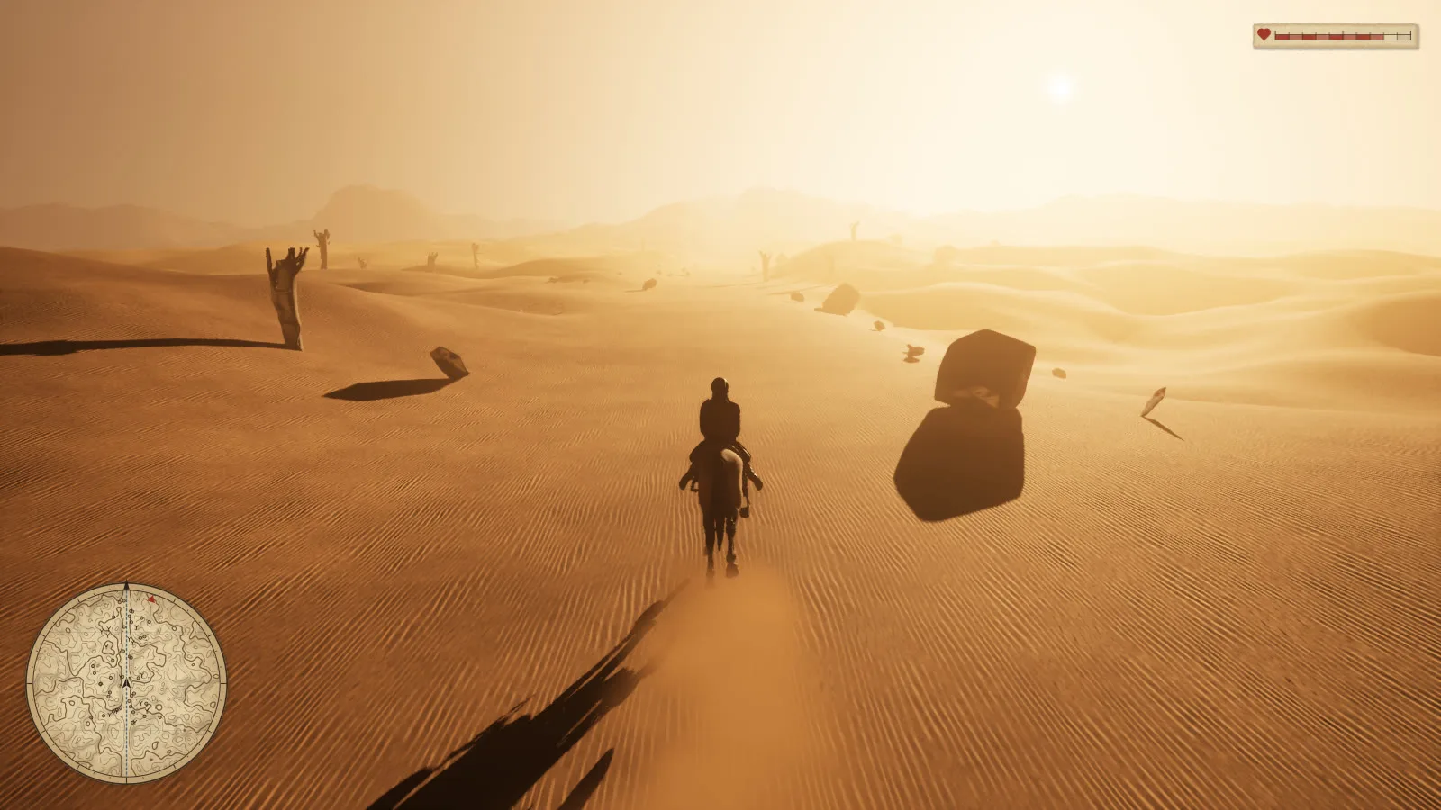
The map is an Ashfold map
The long-term picture is a paper map, in the spirit of Red Dead Redemption 2. The Ashfold make it more than a style choice. They're engineers who have kept water flowing for generations, so they would be map makers. Their knowledge is "local maps, remembered failures, measurements" (BRIEF §3.2). So the minimap is drawn as a surveyor would draw it:
- Contours come from the real ground heights, with a heavier index line every fifth and a sepia wash on the slopes facing away from the light. The heights are smoothed first, the way a cartographer generalises, so dune ripples don't speckle the sheet.
- A faint 100 m survey grid is drawn in blue-grey.
- The dry watercourse runs down the channel floor as the dashed blue line maps use for an intermittent stream. It marks the river that used to run there.
- Ink symbols mark rocks, boulders and dead trees, placed from the actual props.
- A compass bezel has ticks every 10°, and a black pennant marks north. The sheet turns with the camera, so what's ahead on screen is up on the map.
- The map zooms out as she speeds up, and back in at a stand.
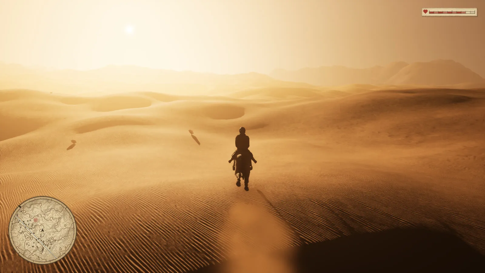
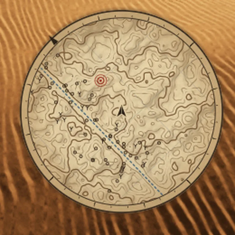
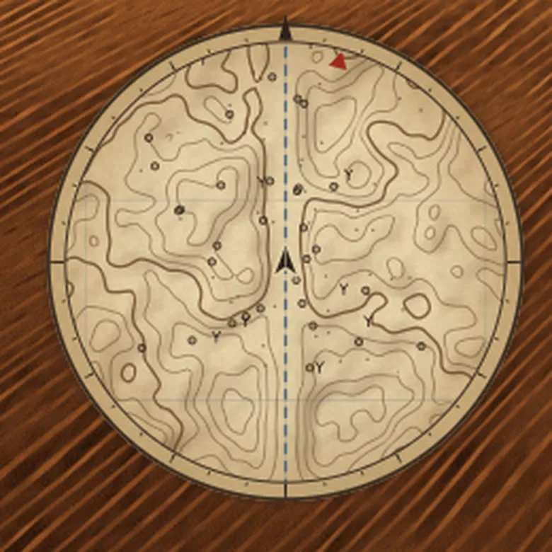
The waypoint is a mark someone made on the sheet, not a quest pin. The BRIEF says the destination should be "a route known through the society's knowledge, not a newly invented quest marker appearing from nowhere." So the goal is drawn in red annotation ink as a survey station (a ring and a dot) where it lies. When it's off the sheet, a red notch on the rim points the way. Nothing floats in the 3D world.
Health
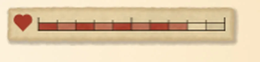
Health is drawn as a surveyor's scale bar on a torn tab of paper: ten divisions with alternating weights, filled in red wash, and a heart in the same red ink.
Never during a cinematic
The letterbox means control is taken, so the HUD stays hidden until the bars have fully gone, then fades in over 0.8 s.
How it's built (the pattern)
- Slate does the layout. The HUD is one overlay on the game viewport (
RideHud.cpp), and later it will handle text and input too. It's all C++, with no UMG assets and no Blueprints. - Each piece is an ink panel.
SInkPanelpaints anFInkCanvason the CPU at the panel's real pixel size, so lines stay one pixel sharp at any resolution. The canvas draws antialiased shapes from distance functions and blends like paint in sRGB. The palette lives inHudInk.h: paper, iron-gall ink, sepia wash, red annotation ink, faded blue water. - Cost. The minimap redraws every frame across all cores, at about 0.6 ms for a 237 px map. The health tab redraws only when its value changes. Surveying the country (1.25 m cells over the ridable area) takes about 45 ms at boot.
- Screenshots and movies include the HUD, so the agent checks it the same way it checks everything else: render a frame and look at it.
- Tunables:
-LwSet="MapSize=285,MapRadius=110,MapRadiusFast=190,WaypointX=330,WaypointY=70,Health=0.8,bHud=false".
Rough edges and next
- There's no text yet. A period face (IM Fell, OFL) would give labels, distances and the inventory a voice.
- The waypoint is a fixed point. In a campaign it would come from mission data: a place the Ashfold already know.
- Inventory goes in the same overlay as another ink panel, a paper sheet with Slate laying out its slots.
Lowwater is in development. These notes capture the game at the time of writing; plans and visuals may change.